
Home Page |
MICHIGAN FORESTS FOREVER TEACHERS GUIDE
|
| H O M E S |
Huron Ontario Michigan Erie Superior |
There are 5 Great Lakes!
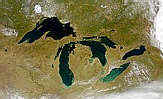
The Great Lakes are one of the natural wonders of the world, although we may not think of them that way because they're right in our own backyard. The great peninsulas of Michigan are unique. Nowhere else is there so much freshwater and so much shoreline.
The Great Lakes have a tremendous influence on our weather, and subsequently on our forests and vegetation. They are important for shipping, a source of industrial and municipal water, fisheries, and tourism. We in Michigan usually don't think about water shortage problems, but many parts of the United States and across the world experience regular shortages of water supply or high quality water. The Great Lakes contain enough water to cover the continental United States with nearly 10 feet of water! Over 33 million people live around the Great Lakes and depend on them for water and other needs.
NASA Visible Earth website:
http://visibleearth.nasa.gov/ |
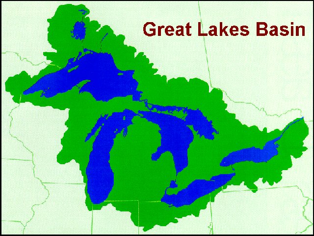
Water flows through the system from Lake Superior, into Lakes Huron and Michigan, then onto Lake Erie, over Niagara Falls, into Lake Ontario, and out the St. Lawrence Seaway to the Atlantic Ocean. Along the way, watersheds gather water from many smaller drainage systems, an area of 196,520 square miles. That's over five times the area of Michigan! The Great Lakes Basin includes portions of seven states and the Province of Ontario. Click here for a profile of the five Great Lakes.
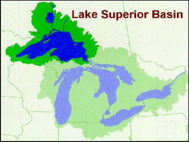
Lake Superior is by far the largest lake in terms of surface area, water volume, and depth. It holds ten percent of the world's fresh water. Only Lake Baikal, in Russia, is deeper and holds more freshwater. Lake Superior is also the highest in elevation and furthest "up" the watershed. Old legends call the lake "Gitchee Gumee". This name has been used in song and verse over the years.
Which lake is smallest is less clear, although most would agree Ontario is larger even if Erie "looks" larger. Ontario is deeper with three times the volume of water, but Erie has 25 percent more surface area. Erie has the greatest number of people living nearby, about 12.5 million. People have caused severe pollution problems in Lake Erie, but thanks to controls and a quicker water replacement time, the lake is recovering.
 |
Source: Michigan State
University Extension and |
Lake Huron has many islands, over 30,000 of them! As result, it also has the most shoreline of any lake . . . almost 4,000 miles! Manitoulin Island, in Canada, is the biggest island in the world, surrounded by freshwater. And if you like confusing word play, Manitoulin Island is the largest freshwater island in the world, which has the largest freshwater lake on an island in the world. That island the largest island, in a lake, on an island, in a lake, in the world!
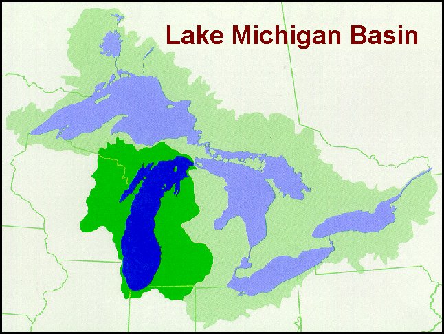
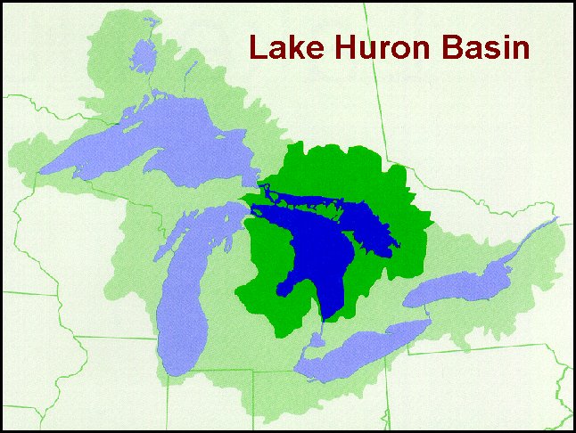
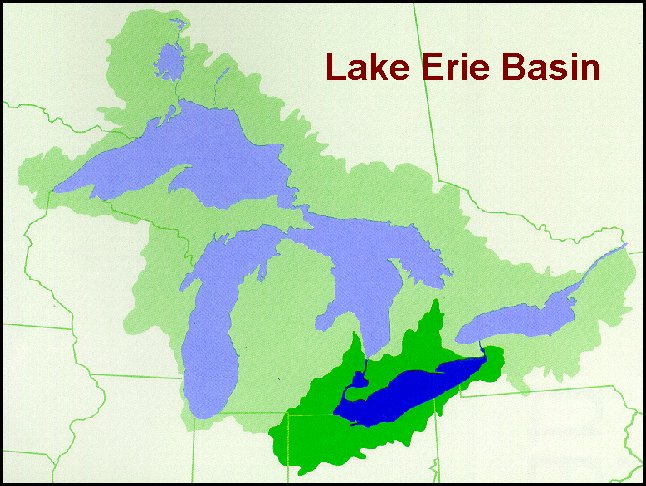
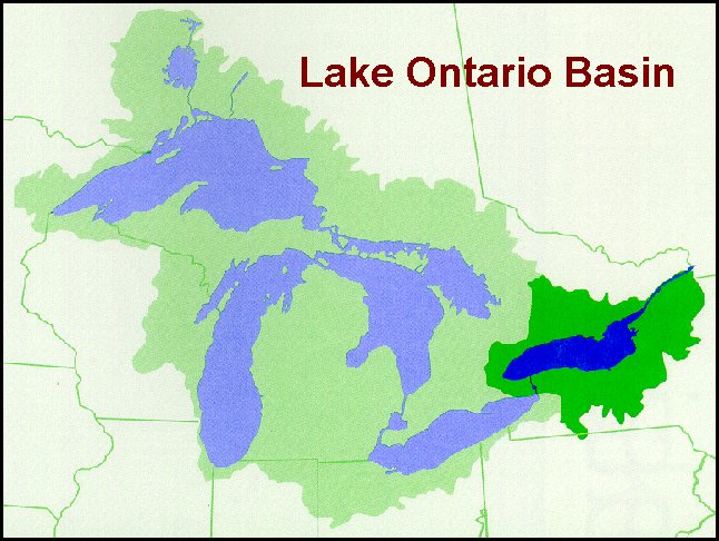
For basin maps of each of the Great Lakes, click on the lake name: Superior, Michigan, Huron, Erie, or Ontario. Each map is based on the "Great Lakes Basin" map to the left, but highlights the basin boundaries of the lake selected.
The biggest threats to Great Lakes are pollution and exotic species. The pollution problems are becoming less each year, but the threat of exotic species is increasing. Two of the most well-known exotic species are the sea lamprey and zebra mussel. Most exotic species are introduced to the Great Lakes by ships from other places in the world.
| Characteristic | Superior | Michigan | Huron | Erie | Ontario |
| Length (miles) | 350 | 307 | 206 | 241 | 193 |
| Width (miles) | 160 | 118 | 183 | 57 | 53 |
| Depth, Average & Max. (feet) | 489 / 1,333 | 279 / 923 | 195 / 750 | 62 / 210 | 283/802 |
| Volume (cubic miles) | 2,935 | 1,180 | 849 | 116 | 393 |
| Surface Area (sq. miles) | 31,700 | 22,300 | 23,000 | 9,910 | 7,340 |
| Drainage Basin Area (sq.miles) | 49,300 | 45,600 | 50,700 | 22,700 | 23,400 |
| Shoreline (miles) | 2,730 | 1,640 | 3,830 | 871 | 712 |
| Elevation (feet) | 601 | 577 | 577 | 569 | 243 |
| Outlets |
St. Mary's River | Mackinac Straits Chicago River |
St. Clair River | Niagara Falls Welland Canal |
St. Lawrence River |
| Water Replacement Time (yrs) | 173 | 62 | 21 | 2.7 | 6 |
| Human Population | 672,116 | 12,052,743 | 2,960,359 | 12,532,977 | 5,692,178 |
| Source: Sea Grant and MSU Extension, 2000 | |||||
 |
This website was developed and created by Michigan State University Extension for the teachers of the State of Michigan. |

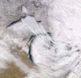 On 5 December, 2000, a storm swept
across the Great Lakes and dropped "lake effect" snow along the southern shore
of Lake Superior and western shore of Lake Michigan. This image clearly shows how
the big lakes can affect local weather and influence regional ecosystems.
On 5 December, 2000, a storm swept
across the Great Lakes and dropped "lake effect" snow along the southern shore
of Lake Superior and western shore of Lake Michigan. This image clearly shows how
the big lakes can affect local weather and influence regional ecosystems.